Leveraging GIS technology to combat invasive conifers
10 September 2019
SHARE

The Mid Dome Wilding Trees Charitable Trust appointed Boffa Miskell to deliver the strategic goal of eradicating wilding trees from the Mid Dome area in Southland.
Boffa Miskell designs an operational plan, manages all aspects of its delivery, and assists with funding bids and wider promotion of the control Programme.
Programme manager Marcus Girvan says, "We are closely involved with research and development of new control techniques, and we carry out trials to measure efficacy and efficiency. To date we have aerially sprayed over 900 hectares of dense wilding trees, and carried out ground and aerial spot spraying control over many thousands of hectares."
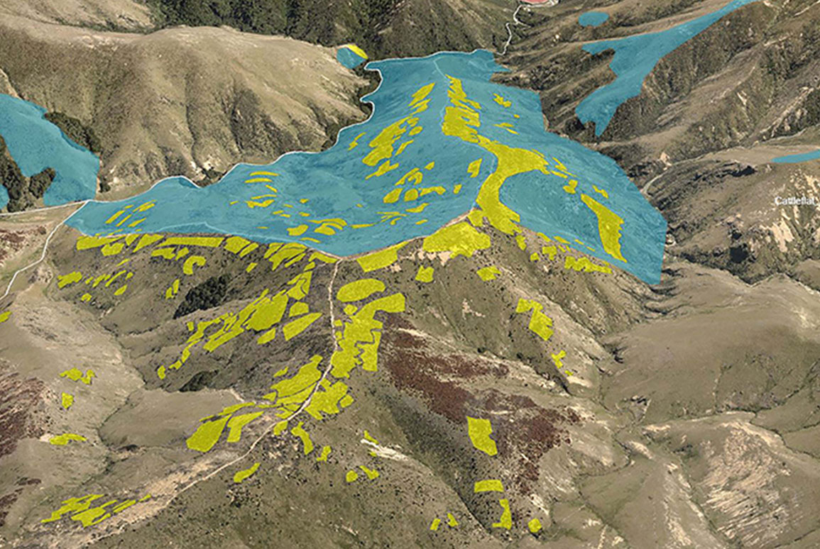
Presenting this information in a 3D web view gives a better understanding of the immense scale and challenging topography of the Mid Dome site. It shows the areas where work was previously completed, the type of control scheduled, and as the control work is undertaken the platform is updated to show progress.
"A fundamental requirement of the geospatial component of this project was that the final output had to be intuitive to use and readily accessible without installing specialist software," says GIS Specialist Brian McAuslan.
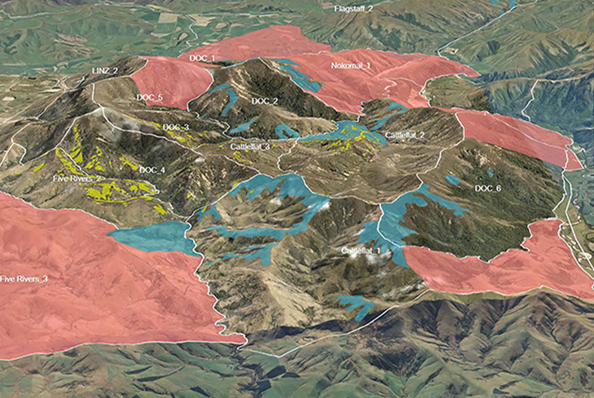
Hi-resolution aerial photography of the site was commissioned and this was used to digitise areas around infestations. Management tools, aerial photography, infestation areas and control programs are loaded into the web viewer.
"With this data the programme team can view any part of the site," says Brian. "They are able to review its previous or projected control to monitor progress, and project partners and stakeholders can easily understand the rationale behind decision-making."
Additionally, the technology enables a more engaging display of data and better communication of the Operational Plan with the Trust, stakeholders, and politicians such as Minister for Conservation, Eugenie Sage; which allows us to showcase the professionalism of the Programme.
Marcus says, "The big breakthrough in landscape-scale wilding tree management will be the development of algorithms to interrogate multispectral imagery and detect wilding conifers in the landscape and to map their distribution in GIS. If we can get this technology working at scale, we can not only tell our control contractors exactly where the trees are, but we can measure our success over time and make accurate control-cost forecasts. It will be a game-changer."