You Need To Know: Thermal Imaging Applications in Biosecurity
13 May 2021
SHARE

New Zealand is known as a world leader in pest eradication. The Predator Free 2050 programme is one of the most ambitious attempts to halt the decline in indigenous biodiversity, and the technology emerging from that initiative has worldwide applications.
Current methodologies for detection and eradication of predators include advanced trapping systems, bait delivery systems, and trail cameras. Advances in camera technology, combined with machine learning, are leading to the possibility of real-time predator detection as a means to deliver more effective control and potential eradication of predators over a wider area.
One example is the use of both ground- and drone-mounted thermal imaging cameras which, when combined with artificial intelligence, help to identify and classify predator species based on patterns of movement, shape and thermal signature.
Many species such as wallabies, deer, pigs and goats are easily detectable by day. However, using thermal imaging equipment at night, when there is a low background thermal signature, can enable the detection of many nocturnal species such as possum, rats and rabbit. There are significant opportunities to integrate this technology into the detection process.
Boffa Miskell began trials with thermal imaging-equipped drones in 2020 with the mounting of a Flir XT2 camera on one of our multi-rotor aircraft. With its 640×320 resolution and radiometric calibration, the camera is able to detect even small species, such as birds, within the canopy of trees. The camera can be calibrated to trigger an alarm, so that when a threshold temperature is breached it will notify the operator. In an automated scenario, this feature could be used to trigger targeted pest control or to geotag the location for further investigation or eradication.
A Current Example
New wetland planting schemes, due to their non-woody nature and fleshy new shoots are particularly vulnerable to browsing from a range of animals. Larger browsing pests, such as deer and goats, can be easily tracked or controlled through strategic placement of temporary fencing. Smaller species — such as rabbits, hares and possums which may be resident in the nearby landscape — are much harder to control, and the cost of protective fencing can be substantial. In order to control such species through baiting, trapping, or strategic culling; it is necessary to pinpoint the location of populations and their range or direction of movement on site. Traditional methods of detection which include searching for evidence of scats, footprints and established animal trails can be time consuming and unreliable.
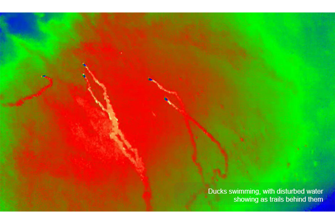
Boffa Miskell trialed the use of its Matrice 210 drone with a high-resolution thermal camera at a Christchurch City Council wetland site to survey for browsing animals. The early morning operation saw the biosecurity and technical services team deploying the drone well before sunrise, when the ambient temperature was at its lowest, to reduce background heat signatures which could confuse the information received by by the camera. Many waterfowl were easily identifiable from the air and the patterns of heat trails in the water made identification of species possible.
At an altitude of 50 metres, the thermal imaging camera was able to detect species such as hares grazing on the ground. At an altitude of 20 metres, features such as ears and hind legs were easily discernable; giving weight to the hypothesis that thermal imaging at high resolution would provide sufficient detail for artificial intelligence (AI) algorithms to classify pests and predators. Staying in the air for up to 30 minutes allowed the team to scan the target area and the wider environment for detailed information on the size of the hare population.
The next step in our research is to use the trigger threshold for temperatures, combined with artificial intelligence, to run automated survey grids on sites in order to evaluate the extent and vectors for damage in wetland, mitigation and restoration planting schemes. This in turn will help to inform which response is the most cost-effective method of dealing with the problem: protection or eradication.
Find out more
Using drone imagery to monitor wetlands from above
For further information please contact Pete Caldwell.