First Person: Mark Brown reflects on the past and present of Christchurch's Red Zone
22 October 2025
Written by Mark Brown
SHARE

In the second article of a series, landscape architect Mark Brown recounts the journey of the Residential Red Zone and shares an insider’s view on the ecological and design decisions made along the way.
The initial announcement of Residential Red Zones on 23 June 2011 was a significant recovery milestone for central Christchurch and surrounding areas following the Canterbury Earthquake sequence of 2010 and 2011.
Red, orange, white and green were the colour-coded designations used to give some definition around the current state of quake-affected areas and homes. Being in the Green Zone meant that generally there were no significant land issues in the area that prevent rebuilding. Orange and white zone areas were also demarcated. Orange zones required further geotechnical investigation to confirm Red or Green zone status, and White zones encompassed Port Hills properties where rockfall and cliff collapse risk had not yet been assessed.
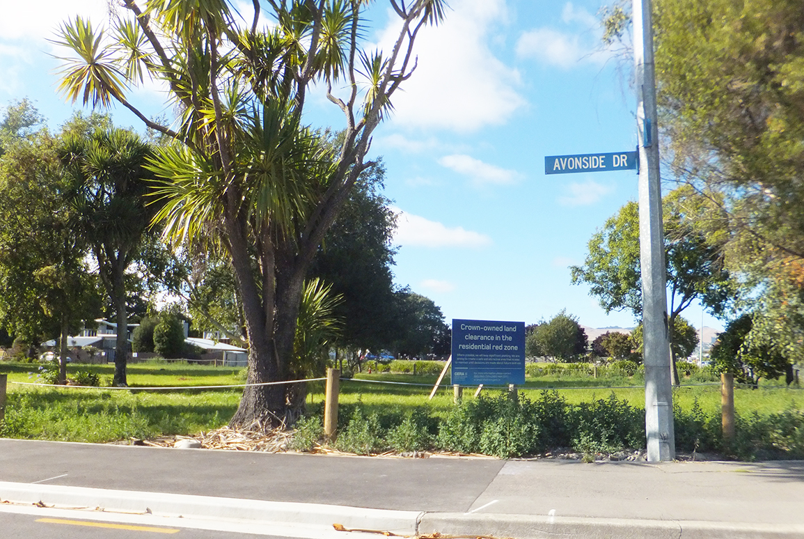
Around 8,000 properties and dwellings were identified as being on 630 hectares of land that was deemed infeasible to rebuild on. This was the Red Zone.
Simply put, the Flatlands Residential Red Zone areas were deemed economically unfeasible to repair on a property-by-property basis. Effective remediation would require comprehensive land improvement at a neighbourhood- or even suburb-wide scale, due to extensive damage from land subsidence, lateral spreading, and liquefaction. The area's vulnerability to future seismic events, along with concerns about the long-term viability of insurance, also contributed to the Red Zone designation. Residents had to move on to new homes and new beginnings.
Looking back, the scale and profound impact of the announcement is etched in the collective memory of Cantabrians, although the disruption to the lives of those in the affected suburbs and settlements has gradually faded over the past decade. The process of negotiating with insurers and relocating was incredibly challenging for those who found themselves living in red-zoned properties. Yet, despite the hardship, the Red Zone decision has ultimately proved to be the right one.
A few weeks before the red zone announcements, two significant aftershocks with magnitudes in the mid- to high-5s on the Richter Scale shook everyone up and caused additional structural damage to already-impacted buildings and wide power cuts. We were given the option to head home from work to check on family and property; and again, I was fortunate. My family was fine, and the house was not damaged any further.
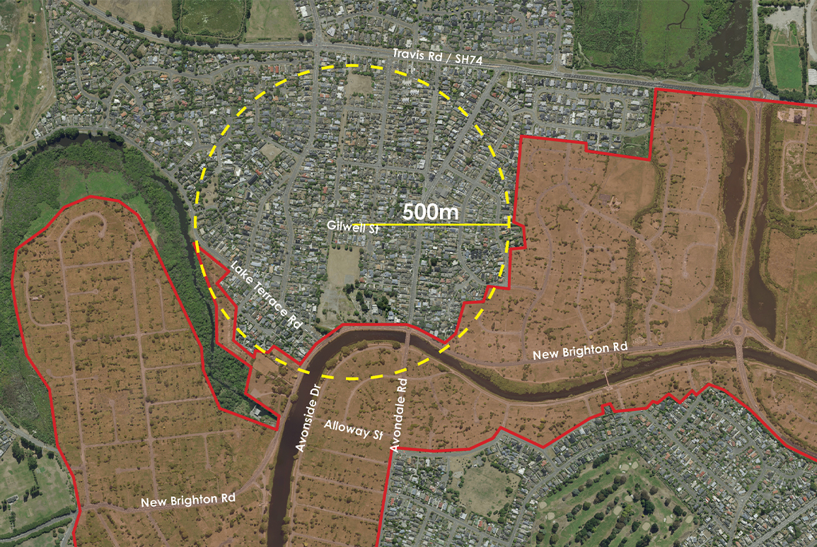
Then my friend Chris called from across the river in Avondale. Just like in February 2011 and September 2010, there was a lot of liquefaction in properties along Alloway Street, where he lived. For many Cantabrians, this was the greatest impact of the aftershocks.
Within the hour, Chris and I, and fellow landscape architect Nik Kneale, were digging about 40cm of silt out of a garage attached to the house of Chris’s elderly neighbour. I wondered how the houses in this area could continue to be lived in, let alone repaired, if this kept happening every time there was a sizeable aftershock.
I soon would have an opportunity to contribute to the initial recovery and on-going management of the residential red zone – a role that provided first-hand experiences that reinforced why this large area of land was no longer suitable for people’s homes.
In late 2011, I became involved in initial work led by the Canterbury Earthquake Recovery Authority (CERA) and Land Information New Zealand (LINZ) to consider how Residential Red Zone land could be treated, once the houses and structures were removed. This evolved into a four-year project, during which I collaborated with Boffa Miskell ecologist Di Robertson to develop a treatment options plan to support CERA and LINZ in managing the land in its interim state, while houses and other structures on private property were being cleared.
At the same time, we worked to shape landscape outcomes that were sensitive to the needs of residents who lived adjacent to the red zone, those who remained in their red-zoned houses (‘the stayers’), and those in the process of moving on. Initial suggestions for treating land and helping to manage dust where houses had been removed in Kaiapoi eventually became the Interim Treatment Management Plan: an understated ‘blueprint’ of what would happen to cleared properties and the spaces where they had been.
Would vegetation be retained or removed?
What would happen to the cleared footprints of houses and driveways?
Did any special features need to be considered in property clearance, such as protected trees or heritage buildings?
Was the property next to a waterway?
Were any of the sites known to be contaminated?
These were just a few of many considerations.
Recently, I caught up with Mat Clark. From an existing role with LINZ, Mat was seconded to CERA in 2011 and tasked with developing and leading the programme to manage clearance of the residential red zone — a mammoth and complex task, of which my work with Di was one of many parts.
Mat and I spoke of the range of challenges that designing an overall plan to clear the land presented. One of the biggest was having a proactive approach to support the thousands of people who lived within the Red Zone; some people needed more support than others. Working with communities and stakeholders who had a vested interest in what might happen in the wider Red Zone, and on the sites of their homes, was essential.
We recalled a key parameter for the treatment options we were developing with CERA: the final land use had not been determined, so the treatment options could not preclude or hinder potential future land uses — essentially, there was no known end state. Grassing much of the Red Zone was a likely cost-effective and manageable treatment option, but it wasn’t suitable for all locations. We learned this by examining a range of data and visiting various locations in the Red Zone during different weather conditions and seasons.

The Interim Land Clearance Treatment Plan included a range of categories for how Residential Red Zone land should be treated following removal of individual houses and structures. Grassland, Riparian Buffer, Dune, Estuarine Edge, Wet and No Clearance Treatment areas were identified, reflecting the varying landscape conditions across the expanse of the red zone. Guidance was provided regarding existing vegetation to be retained and removed, as well as a strategy to manage and remove the invasive weed species. This significantly shaped the way the Red Zone has looked in its interim state up to the present day.
With the plan in place, attention turned to clearance and implementation. Unsurprisingly, this took time due to the complexity of the situation.
Several earthquakes and aftershocks meant multiple claims split between the central government-funded Earthquake Commission (EQC) and private insurers were related to individual properties. Settlements proceeded over varying timeframes. Mat Clark says that this had on-going impacts, as the initial concept for clearing the Red Zone was simply to start at one end and work to the other. In reality, clearance eventuated more slowly in a patchwork approach, as areas of land became feasible to treat once a critical mass of properties had insurance claims settled, and the residents had moved.
Mat recalls ‘the grind’ of this period. The initial recovery phase was over, but the city was just starting the rebuilding phase.
I asked Mat what he thinks the successes of the clearance programme were, and it’s reassuring that he identified many aspects that I had:
- The land was well-maintained and in good condition when it was handed over to the Waimakariri District Council in 2018 and the Christchurch City Council between 2019 and 2023. The land was ready to be adjusted to a defined end state or to be maintained in an ongoing interim state.
- Progressively, the Red Zone was opened for public use, including passive recreation.
- Mapping the existing fruit trees, and making that information publicly available, was a great outcome of the process to retain existing vegetation
The project wasn’t without controversy or media attention but, compared to many aspects and projects that have comprised Christchurch’s recovery, the clearance project largely ‘flew under the radar’. Mat credits this to the time and effort made to engage with Red Zone residents and stakeholder groups, and the additional support provided to those residents who needed help.
Most importantly, the vast majority of Red Zone residents were able, in time, to move on with their lives, and the sites of their former homes were treated well.

What’s the Red Zone like now?
In North Kaiapoi, a large chunk of land has been converted into permanent park space and sports fields. In Christchurch, the Ōtākaro Avon River Corridor (as space alongside the river is now known) still has a considerable area in an interim state. Christchurch City Council is progressing comprehensive design work to transform much of this into integrated flood protection, stormwater management, and permanent parkland, and local landscape architects continue to contribute to what will be a great infrastructure and recreation asset for the city.
With the City to Sea Path, revegetation planting, Avon Park, and new pedestrian and cycle bridges across the river, visitors to the Ōtākaro Avon River Corridor can sense how the wider area will evolve in the coming decade.

Today, in October 2025, I’ve enjoyed warm spring mornings walking along the riverside path between Avonside and Richmond. I’m not alone: lots of people are walking, running, cycling, or out with dogs. They're enjoying and making the most of the spaces that have been reinvigorated. It’s certainly very different from the homes and communities that once were present here; but it's a positive and appropriate outcome, and it bodes well for what will come for the remainder of the Residential Red Zone.
