When location matters: consenting homes in sensitive environments
21 May 2026
Written by Kate Morrissey
SHARE

From character streets to rural ridgelines, location plays a key role in how residential development is assessed. Auckland-based planner Kate Morrissey explains what homeowners need to consider when building or renovating in areas subject to additional planning controls.
For homeowners planning a new dwelling or a substantial renovation, the most significant consenting challenges often arise not from the scale of the project, but from where the property is located. Sites within defined special character areas or sensitive rural landscapes are subject to different planning controls; and understanding these early can make a considerable difference to both design outcomes and consenting timeframes.
In urban areas, this typically includes properties located within Special Character Areas and Heritage Precincts, particularly across early settlements established in the late 19th and early 20th centuries. In rural and coastal settings, residential development is often proposed on land identified for its high or outstanding natural character; or on prominent ridgelines where buildings are highly visible in the wider landscape. In these locations, resource consent is commonly required for both new dwellings, and additions or alterations, even where development might otherwise be anticipated within the zone.
District and Unitary Plans provide the framework for assessing this type of development. They include detailed descriptions of special character areas and scheduled landscapes, setting out the specific qualities and characteristics that are being managed. Objectives, policies and matters of discretion then guide how a new development is assessed, enabling councils to ensure that these values are protected, maintained or enhanced as change occurs.
For private homeowners, these planning provisions can be complex to navigate. Early involvement of a resource consent planner can help interpret the planning framework, explain how it applies to a specific site, and identify any key sensitivities before design work is finalised. This advice often helps avoid unnecessary redesign and provides greater confidence as a project progresses through the consenting process.
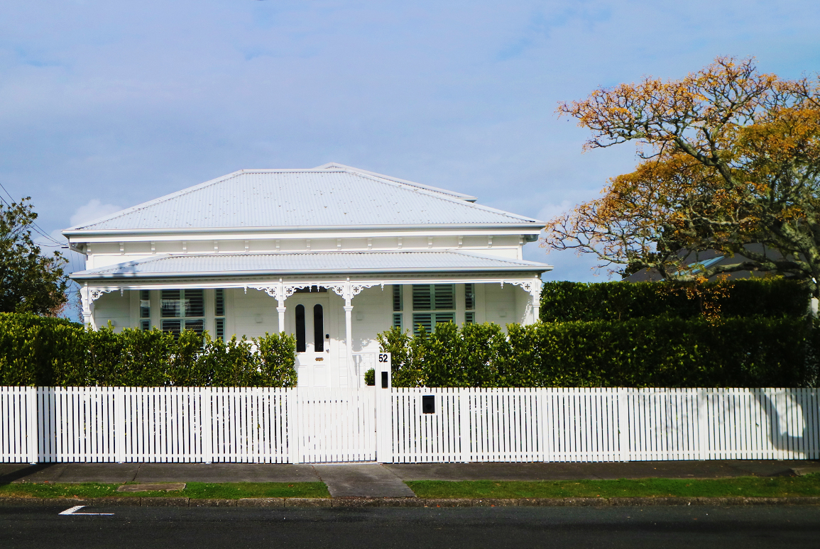
Special Character Areas
Special Character Areas and Heritage Precincts are predominantly urban, and their value comes from more than just individual houses. While architectural style is important, character is also shaped by development patterns such as road layouts, lot sizes, spacing between buildings, vegetation and overall streetscape coherence. These elements together create the distinctive neighbourhood qualities that planning provisions are seeking to manage.
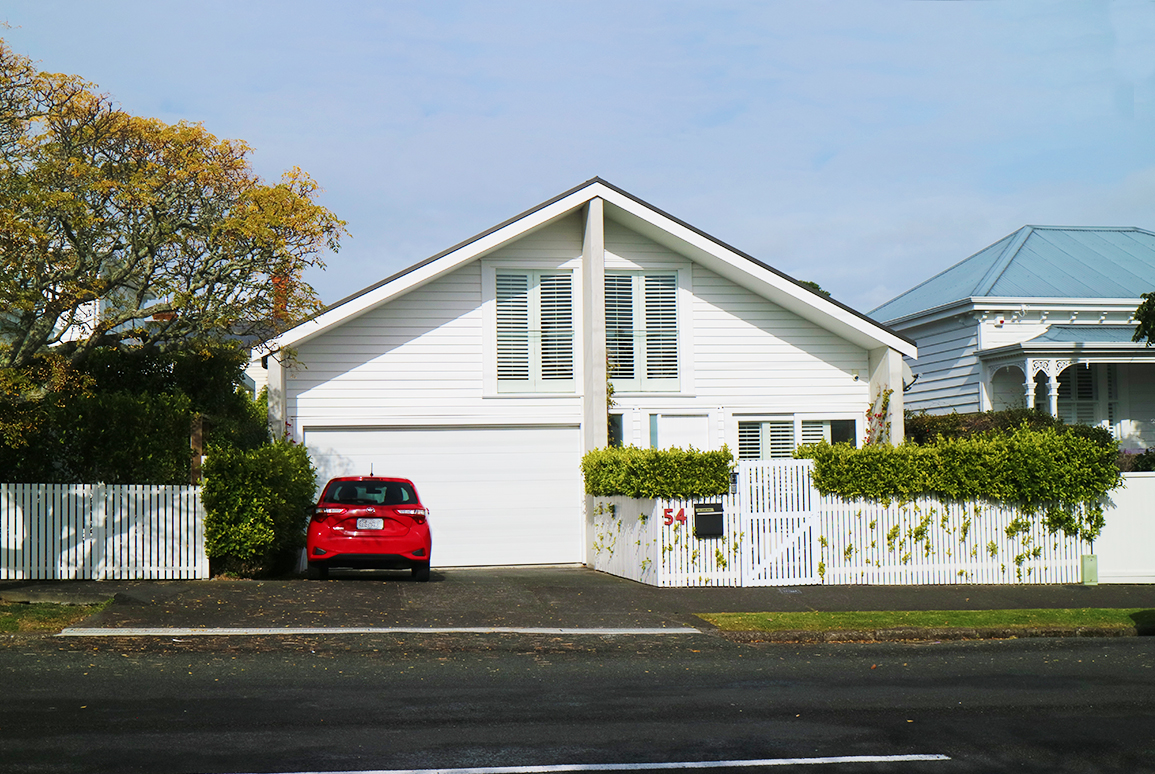
Many homeowners have successfully renovated and extended older dwellings within these neighbourhoods. Well‑designed additions are entirely possible, provided they respond carefully to the existing context and do not undermine the qualities that define the area.
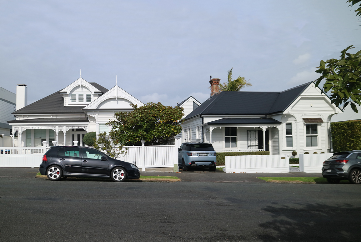
A common feature of these neighbourhoods is ribbon development, where houses are located close to the street on relatively narrow sites, with deeper rear garden areas. As a result, extensions are usually located to the rear of dwellings. Even so, potential effects on neighbours, including bulk, dominance, and shading, still need to be carefully assessed. Changes visible from the street are typically subject to a higher level of scrutiny and are expected to respect key architectural features of the existing dwelling, such as roof form, materials and detailing.
Importantly, development controls do not always require exact replication of original building materials or detailing. In some circumstances, alternative materials may be appropriate. Over time, neighbourhoods naturally evolve as houses are updated and modified, and planning interpretation also changes. The degree of acceptable change varies between suburbs and individual streets, reinforcing the importance of assessing each site on its own merits rather than relying on assumptions or nearby examples.

Rural Landscapes
Rural properties present a different set of considerations. These landscapes are diverse, shaped by physical landform and vegetation and also land use activities. Planning provisions reflect this variety through different rural zones. These zones typically provide for farming activities alongside residential use, with controls that vary depending on landscape sensitivity and location.
Beyond dwellings and buildings accessory to pastoral farming, one dwelling per site may often be anticipated, particularly on larger rural titles, subject to controls on height, coverage and setbacks. However, additional controls often apply if a site is located within a sensitive landscape, such as a coastal environment; a prominent ridgeline; or an outstanding natural landscape or area of high natural character. Development is not necessarily precluded, but greater care is required in how buildings are sited, designed and integrated into the landscape.

For homeowners, this means considering not only the dwelling itself, but also associated elements such as earthworks, retaining, vegetation clearance and driveways. These aspects can have a significant influence on landscape character and visual effects, particularly in open or elevated rural settings, and they form a key part of the consent assessment.
Finding the most appropriate building location on a rural site often involves balancing practical considerations such as ground conditions and access with landscape sensitivity and visual exposure. Because of this complexity, consent applications for rural dwellings commonly draw on advice from multiple specialists, including geotechnical engineers, ecologists, civil engineers and architects. Where landscapes are protected, an assessment of landscape and visual amenity effects by an experienced landscape planner is usually required.
In this context, a resource consent planner can help homeowners understand which assessments are likely to be needed, what mitigation measures may be expected, and how best to shape a proposal so that it aligns with planning objectives. This coordinated approach can provide clarity and reduce uncertainty throughout the consenting process.

Planning Reform and continued relevance
Proposed planning reform through the Natural Environment Bill and the Planning Bill seeks to simplify aspects of planning decision‑making. Section 14 of the Planning Bill provides that certain effects must be disregarded, including effects on landscape and the visual amenity of a use, development or building in relation to its character, appearance, aesthetic qualities, or other physical feature. However, the Bill retains the ability to manage development within areas of high natural character within the coastal environment, wetlands, lakes, rivers, and their margins or outstanding natural landscapes and features, sites of significant heritage and sites of significance to Māori (among other things).
At the same time, both proposed reform and recent national direction have increased the importance placed on natural hazard considerations in planning decision‑making. This is likely to remain a key consideration for new residential development, regardless of location.
For homeowners considering residential development in sensitive urban or rural environments, resource consent will therefore continue to be an important part of the process. While planning frameworks may change over time, carefully assessing site constraints, understanding council expectations, and obtaining early professional advice remain central to achieving successful and well‑designed outcomes.