You Need to Know: the Spatial Planning process
23 November 2025
SHARE

Spatial plans are a long-term, strategic approach to guide development by coordinating land use, infrastructure, and environmental management to achieve desired outcomes.
Just as every town, district and region in Aotearoa New Zealand is unique, so is the spatial plan that identifies its particular opportunities and constraints, sets strategic objectives, and creates a shared vision for balanced growth that addresses social, economic, and environmental well-being.
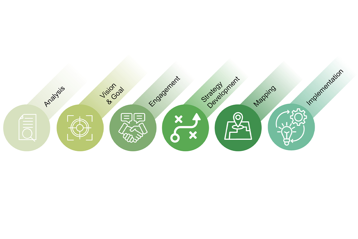
However, the process of developing a robust spatial plan encapsulates specific key steps, including evidence-based analysis, community engagement, creating a comprehensive spatial plan document (including mapping), and developing implementation plans to ensure future development aligns with the long-term goals.
Looking at complex issues in an integrated and coordinated manner is a strength of the Boffa Miskell team. We work collaboratively to assist clients in understanding the wide range of relevant matters that need to be addressed in the spatial planning process.
- Analysis: The spatial planning process begins with analyzing current and future opportunities and constraints, which can include natural hazards, climate change impacts, land use patterns, and infrastructure needs. This analysis is evidence-based and considers social, economic, environmental, and cultural factors.
- Vision and goal setting: This sets a long-term direction and strategic objectives for an area. The vision helps to create a shared understanding of what the region should look like in the future, often looking 30 years or more ahead. This step involves broad engagement across a range of stakeholders: residents, mana whenua, community groups and business interests, and government entities.
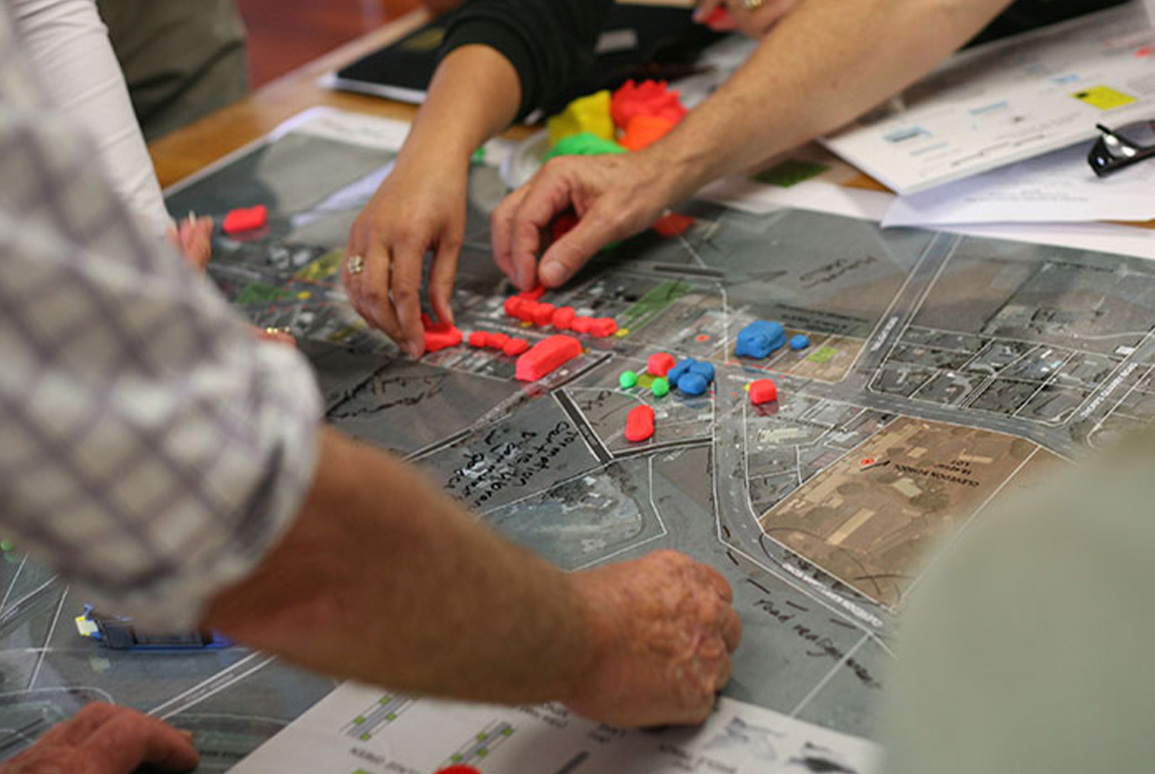
While a spatial plan provides a broad vision, it is crucial to create that vision collaboratively, through consultation and engagement with mana whenua, local partners and stakeholders. Empowering these groups to participate in decision-making, ensures that the spatial plan hierarchy reflects their unique needs and aspirations from the ground up.
Boffa Miskell’s engagement specialists, cultural advisors, urban designers and landscape architects are skilled at facilitating targeted community and stakeholder spatial plan optioneering workshops. Working in collaboration with project partners, we are committed to providing a methodical, evidence-based process that puts community at its heart, ensuring that the final Spatial Plan reflects the ideas, wishes and aspirations of the people who have a connection with the district.
- Community engagement: Throughout the process, there are discussions and input from communities, iwi, local authorities, and other stakeholders to ensure the plan reflects local needs and values.
- Strategy development: A comprehensive strategy is developed that integrates various considerations, such as future housing and business locations, new infrastructure, and areas that need to be protected.

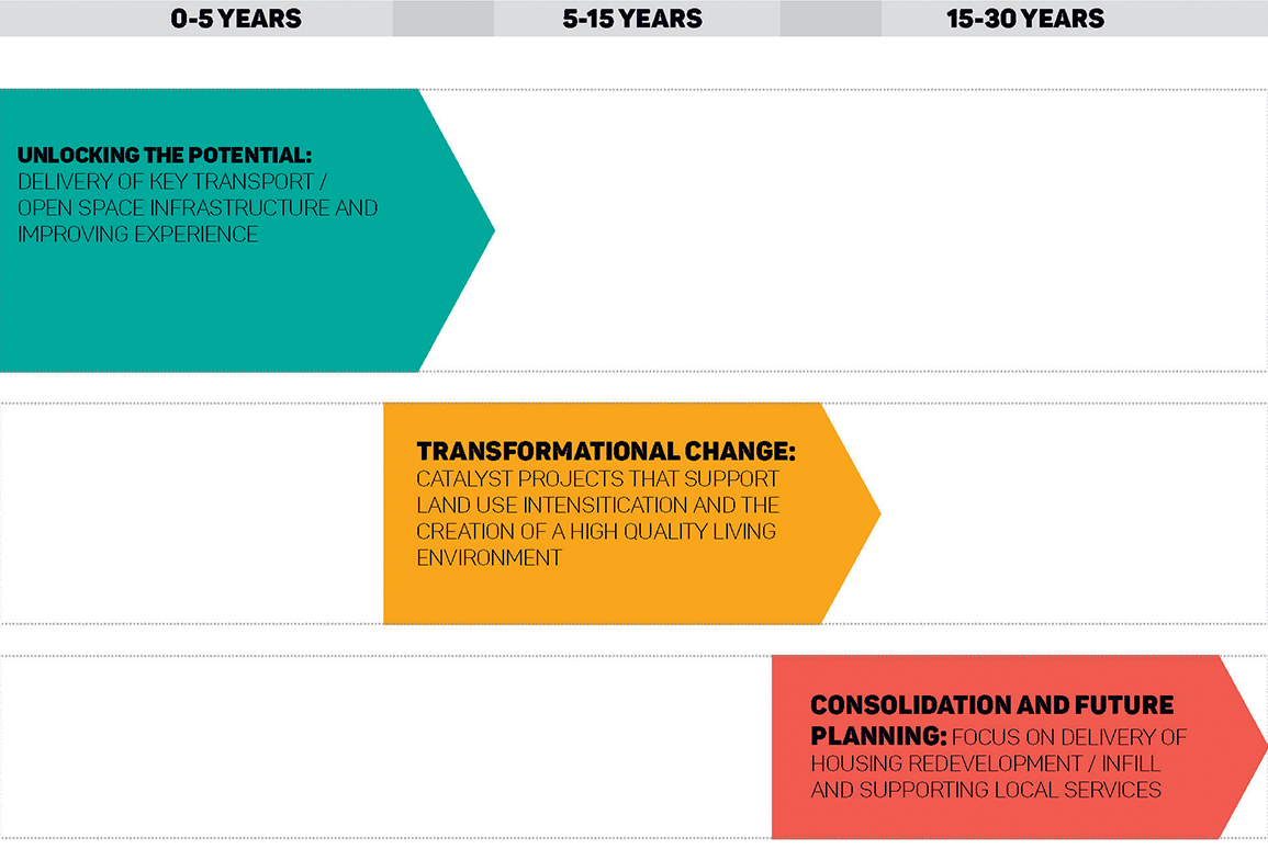
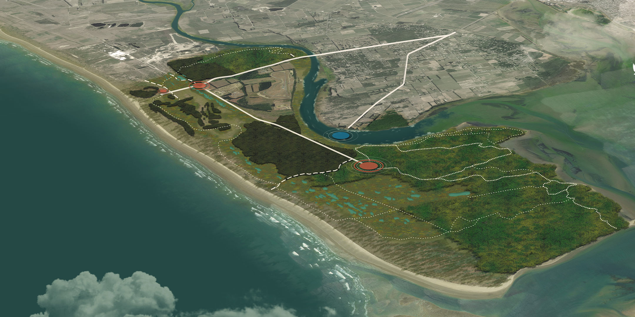
The spatial planning process identifies environmental, cultural, and physical limitations. Then, through the designation of land uses and the layering of key systems, such as Blue-Green Networks, transport, and infrastructure, a spatial plan creates a coherent framework for sustainable development over a period of years, or decades.
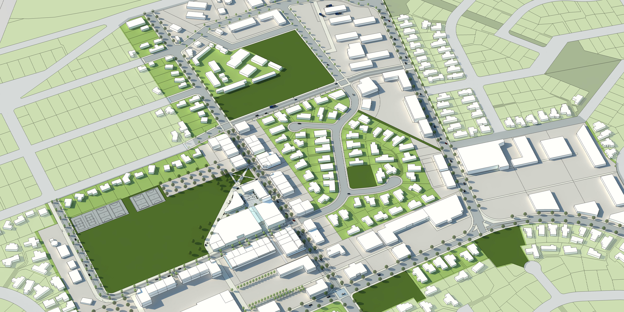
Using geospatial data to create detailed, visual representations of an area to inform and guide decisions about future land use, infrastructure, and environmental management transforms abstract policy into a concrete, visual roadmap for development.
- Mapping and spatial representation: Maps are a critical tool for illustrating the plan: showing where development should go and where growth is prioritized; how people will move in, around and through; and what areas are sensitive zones, culturally significant, or require protection.
- Implementation & Alignment: Once adopted, the spatial plan provides a framework for aligning other regulatory plans, funding programs, and informing investment decisions by various agencies. It also guides the development of specific projects and infrastructure improvements over time.
Related Projects

Mackenzie Spatial Plans
South Island

Ohakune Spatial Plan
North Island

Richmond Spatial Plan
South Island

Milford Opportunities Project (Stage 2) Masterplan
South Island
Rolleston Town Centre Masterplan
South Island

Te Kirikiri | Frankton Masterplan
South Island
Sandy Point Domain Masterplan
South Island

Auckland City Centre Masterplan 2020
Auckland