Boffa Miskell’s role was to help translate this complexity into a clear, spatially explicit and implementable planning framework. The team led technical analysis, GIS-based mapping, spatial gap identification, stakeholder engagement, project identification and the integration of landscape, ecology, planning and urban design expertise. Basin-scale analysis of geomorphology, hydrology, historic vegetation patterns, ecological networks, growth projections and climate modelling informed local responses that are specific to landscape character and development pressures.
The Blue-Green Network Plan is a direct response to the 2021 Queenstown Lakes Spatial Plan's outcome of “Well-designed neighbourhoods that provide for everyday needs" and strategy to “Enhance and protect the Blue-Green Network” by identifying spatial opportunities and guiding investment in open space, ecological corridors, and water systems.
The Blue-Green Network Plan complements the Queenstown Lakes Spatial Plan by:
- Informing structure plans and development contributions policy,
- Supporting the Future Development Strategy, and
- Aligning with other strategic documents such as the Climate and Biodiversity Plan, Parks and Open Spaces Strategy, and Community Facilities Strategy.
Kāi Tahu are integral partners in the development and implementation of the Blue-Green Network Plan. Values of mauri (life force), mahinga kai (traditional food gathering), manaakitaka (hospitality), and kaitiakitaka (guardianship), are embedded throughout the plan.
A dedicated report, Kāi Tahu Blue Green Network Ki Uta Ki Tai, outlines cultural outcomes and expectations, and provides interim methods for continued collaboration. The Blue-Green Network Plan supports mana whenua-led assessments, access to ancestral sites, and restoration of cultural practices through ecological enhancement and public access.
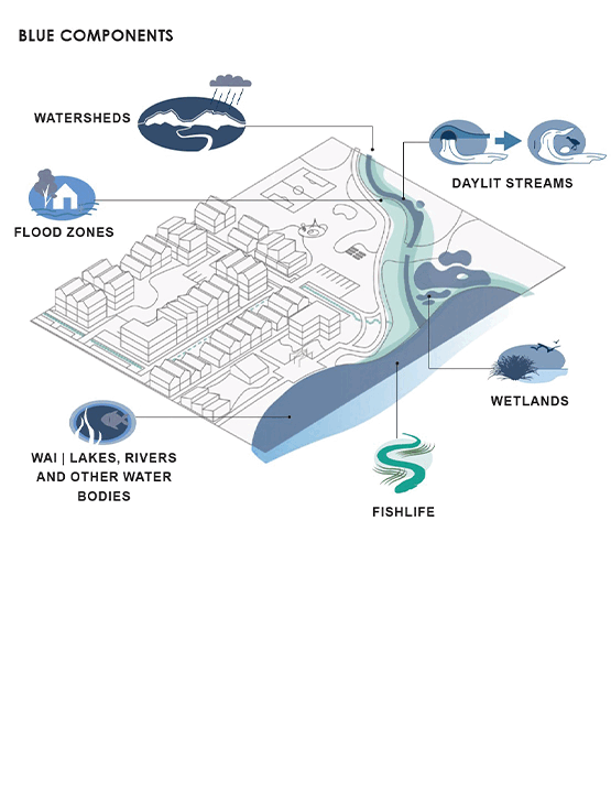
The Blue-Green Network is a landscape-scale system comprising three interconnected layers:
Blue Network:
- Lakes, Rivers, Streams, Creeks: Including Whakatipu-Wai-Māori, Wānaka, Hāwea, and the Mata-Au/Clutha River.
- Wetlands: Transitional zones supporting biodiversity and water filtration.
- Green Infrastructure: Nature-based solutions such as swales, rain gardens, and constructed wetlands.
Green Network:
- Natural and Scenic Reserves: Including National Parks and QEII covenanted lands.
- Ecological Corridors: Linking fragmented habitats to support flora and fauna.
- Indigenous Vegetation: Riparian planting and restoration of native ecosystems.
Community Network:
- Parks and Open Spaces: Local, community, and premier parks for recreation and social interaction.
- Tracks and Trails: Active transport routes connecting neighbourhoods, destinations, and natural features.
- Streets and Civic Spaces: Urban spaces that balance movement and place functions.
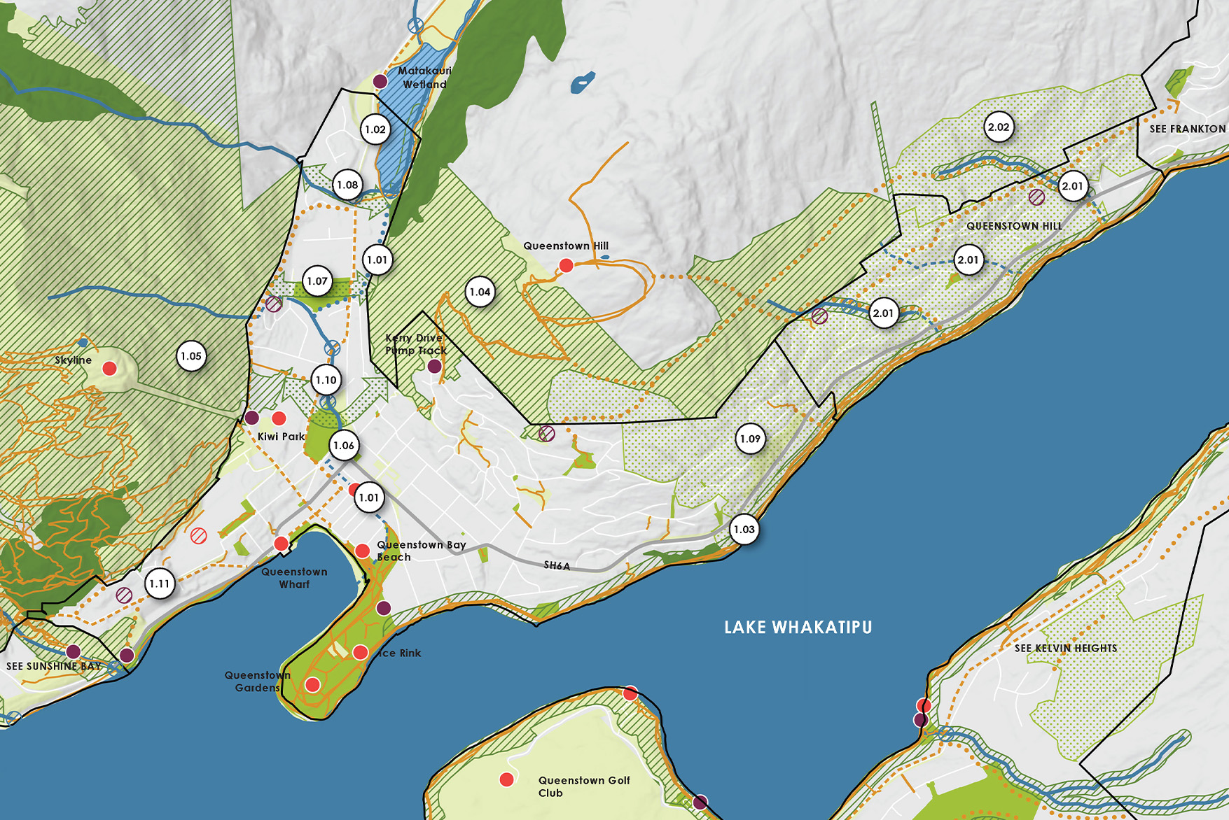
The Blue-Green Network Plan focuses on 21 Priority Development and Settlement Areas identified in the Queenstown Lakes Spatial Plan, clustered across two basins:
Whakatipu Basin: Includes Queenstown, Frankton, Arrowtown, Glenorchy, Kingston, and surrounding corridors.
Upper Clutha Basin: Includes Wānaka, Albert Town, Lake Hāwea, Luggate, Cardrona, and Makarora.
Each area has a Local Blue-Green Plan, detailing site-specific opportunities for waterway restoration, ecological enhancement, park development, trail connectivity, and cultural recognition.
Key Benefits of the Blue-Green Network
The Blue-Green Network Plan delivers multiple co-benefits across environmental, cultural, social, and economic domains:
- Ecological Connectivity: Supports biodiversity and landscape-scale systems.
- Water Quality and Resilience: Enhances Te Mana o te Wai through riparian planting and stormwater management.
- Climate Adaptation: Provides space for water flow, mitigates flooding, and supports carbon sequestration.
- Recreation and Wellbeing: Offers inclusive, accessible spaces for sport, leisure, and social interaction.
- Cultural Recognition: Restores mahinga kai and supports Kāi Tahu values and practices.
- Education and Stewardship: Fosters community engagement and environmental awareness.
- Sustainable Development: Encourages compact urban form and protects natural systems.
- Tourism and Amenity: Enhances visitor experience through connected trails and scenic landscapes.
Implementation and Future Planning
The Blue-Green Network Plan informs QLDC’s long-term planning and investment decisions. Key implementation mechanisms include:
- Integration into structure plans and development contributions policy.
- Alignment with asset management and reserve management plans.
- Collaboration with Kāi Tahu on planting guides, strategic work programmes, and mahinga kai plans.
- Mapping of waterways and ecological corridors to guide land acquisition and restoration.
A separate Blue-Green Network Action Plan will detail priorities, timeframes, responsibilities, and funding pathways.
The Blue-Green Network Plan is a transformative framework for embedding nature into urban development. It reflects a shared commitment to ecological integrity, cultural heritage, and community wellbeing. By aligning with the Queenstown Lakes Spatial Plan and partnering with Kāi Tahu, the BGN Plan ensures that growth is guided by values that protect and enhance the district’s unique landscapes for generations to come.
Services provided: Urban design, landscape architecture, ecology, transport planning, landscape planning, engagement, and digital.