Boffa Miskell played an advisory and technical role in shaping the Phase One deliverables of the Thames and Surrounds Spatial Plan, providing the evidence base and strategic analysis needed to inform long-term decision-making. Phase One focused on Investment Logic Mapping (ILM), optioneering, the development of Urban Design (UD) principles and spatial plan objectives, and a Multi-Criteria Analysis (MCA) to test and refine future growth options ahead of presentation to council.
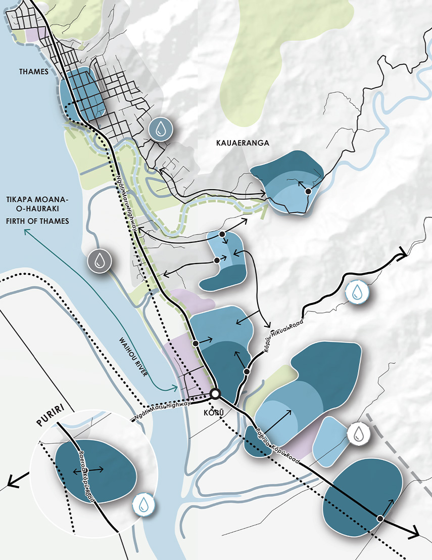
Detailed site investigations and GIS-based spatial analysis helped build a clear picture of existing conditions, constraints and opportunities across Thames. This work underpinned a series of council-led workshops facilitated by Boffa Miskell, bringing together planners, infrastructure managers and senior staff to identify risks, challenges and community aspirations, and to clarify council’s strategic intentions for the next 30 years.
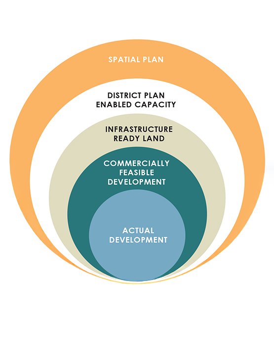
A key component of Boffa Miskell’s Phase One input was identifying planning rules and policy settings that are currently constraining growth, and outlining pathways to address these barriers through the spatial plan.
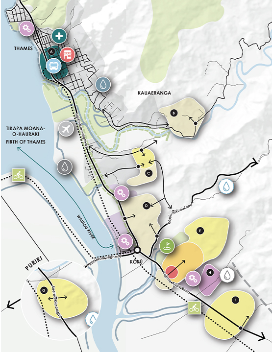
Phase Two focused on preparing the Spatial Plan and engagement material, while integrating the Shoreline Management Plan, infrastructure investment planning and growth staging in response to significant coastal inundation challenges. Boffa Miskell led and integrated the key workstreams underpinning Phase Two, translating earlier strategic analysis into a clear, community-facing plan and engagement programme.
The final Thames and Surrounds Spatial Plan, also known as "Your Thames, Tomorrow," provided Council with a clear, integrated roadmap to guide future growth, infrastructure investment and community decision-making.
Spatial Plan aims to:
- Enable coordinated and sustainable urban expansion.
- Address housing shortages and affordability.
- Support economic development and workforce retention.
- Mitigate risks associated with climate change and coastal hazards.
- Align infrastructure investment with projected growth.
- Protect and enhance the town’s cultural, environmental, and heritage values.
Economic Constraints and Workforce Shortages
Thames contributes nearly half of the district’s employment but only houses 36% of its population. A stagnant population and ageing demographic (35% aged 65+) are reducing the available workforce. Businesses report difficulty recruiting staff due to a lack of housing, particularly rentals. This imbalance threatens economic resilience and growth.
- 25% of Thames’ workforce commutes from outside the area.
- Only 36% of residents are employed full-time; 46% are not in the labour force.
- Lack of housing is cited as the primary barrier to business viability.
Housing Supply and Affordability
Thames has experienced a chronic undersupply of infrastructure-enabled, commercially viable land for housing. The cost of land and infrastructure access has inhibited development.
- The average age of a house is 55 years.
- 17% of homes are unoccupied; long-term rentals are scarce.
- Thames is among the most unaffordable districts in New Zealand, with a housing affordability index of 17.2 (compared to 8.8 nationally).
- Only 16 homes have been built annually over the past decade, far below the 70 homes/year needed to meet demand.
Climate Change and Coastal Hazards
Thames’ low-lying coastal geography makes it highly vulnerable to sea level rise, coastal erosion, and flooding. These risks undermine investor confidence and pose long-term threats to infrastructure and property.
- $408 million in assets are currently at risk; this could rise to $1 billion long-term.
- Up to 84% of commercial zones and 83% of light industrial zones are at risk under 1.0m sea level rise scenarios.
- The Shoreline Management Plan recommends a mix of protection, managed retreat, and adaptation strategies, including new stop banks and improved stormwater systems.
Infrastructure Limitations
Water and wastewater infrastructure are critical constraints to growth.
- Wastewater treatment capacity is limited; upgrades are needed to support short-term growth.
- A new wastewater treatment plant is proposed for long-term resilience.
- Water supply upgrades and new sources (e.g., Kirikiri Stream catchment) are required to meet future demand.
- Transport infrastructure must be improved to support growth corridors and regional connectivity.
Environmental and Topographical Constraints
Thames’ unique landscape presents physical limitations to development.
- Highly constrained land includes areas prone to flooding, steep slopes, conservation zones, and significant natural features.
- Moderately constrained land may be developable with mitigation.
- Unconstrained land offers the most potential for greenfield development and is prioritised in the Plan.
The Thames and Surrounds Spatial Plan provides a comprehensive framework to address the town’s complex challenges while enabling sustainable growth. It balances development with environmental protection, cultural heritage, and community wellbeing. By aligning infrastructure, land use, and policy, the Plan positions Thames to thrive as a resilient, inclusive, and economically vibrant community.